

Understanding where things happen, and why
Photos courtesy of Tracy DeLiberty and Mary Shorse January 23, 2023
UD faculty and staff spread geography awareness throughout Delaware
Geography is an exciting, interdisciplinary field that uses cutting-edge technology to explore places and the relationships that people have with the environment that surrounds them. For people unfamiliar with the field, however, the topic may mean nothing more than looking at a map.
During the fall of 2022, faculty members and staff from the University of Delaware’s Department of Geography and Spatial Sciences and the Delaware Center for Geographic Education engaged in outreach programs at local middle schools and hosted competitions to raise awareness about the power of geography as well as possible career opportunities that could be attained through the field.
Tracy DeLiberty, associate professor in geography and deputy dean of the College of Earth, Ocean and Environment, and Mary Schorse, an adjunct faculty member in the geography department who directs the Delaware Center for Geographic Education, spearheaded outreach events at George Read and McCullough middle schools, both in New Castle. The project was funded by a grant from AmericaView — a nationwide, university-based, and state-implemented network that focuses on education and outreach for remote sensing and satellite imagery.
Schorse explained that they began each class by giving the students a broad overview of everything that geography entails.
“We work really hard to make sure that students and teachers recognize that geography is studying the earth and understanding what’s happening in total,” said Schorse. “It’s not memorizing places and states and capitals, which is often what people think about when they think about geography. It’s about understanding what is happening where and why.”

DeLiberty added that they also show the students various tools they work with as geographers.
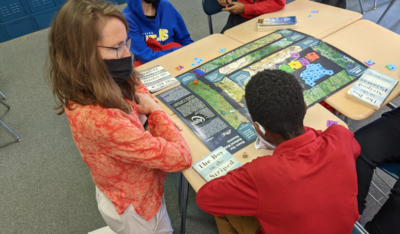
“These tools include everything from handheld global positioning systems, imagery, and a drone — which everybody wants to fly,” said DeLiberty. “Then we play a student game that is all about the utilization of water.”
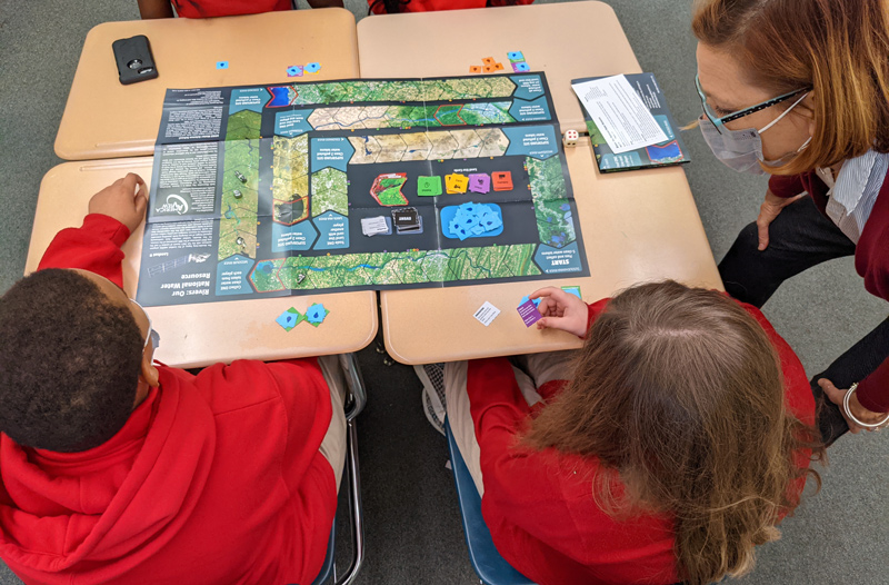
DeLiberty and Schorse helped develop the board game through their involvement with AmericaView in collaboration with the United States Geological Survey (USGS) and NASA. The board illustrates with Landsat imagery six unique river systems across the United States; the game allows students to see how geography influences where they get their water from and how water is used, both for drinking and for making certain products.
The game showcases a variety of rivers, such as the Susquehanna, the Colorado River and the Chicago River to illustrate both rural and urban areas and emphasize how varied the water sources are in America.
“The students are really surprised to learn all the different ways we use water and how much water is a part of everything that is in our daily lives,” said Schorse. “Game cards teach students about just how many gallons of water go into making products we use every day — a pair of jeans, a car, a cell phone or a pound of almonds.”

The hope is that by raising awareness of water use issues, students will not only gain a new appreciation for geography, but also realize how important it is to protect the planet’s water sources.
“The students realize how quickly we can use or pollute finite water resources,” said DeLiberty. “For instance, if there’s a snowstorm in Chicago, and all the runoff — such as the salt and everything else we put on the land — makes its way into the water, they see the impact on overall water quality.”
GIS Day in Dover
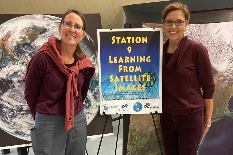
DeLiberty and Schorse also took part in the annual Geographic Information Systems (GIS) Day Field Trip Event at the Dover Air Mobility Command Museum that was attended by around 300 fifth grade students.
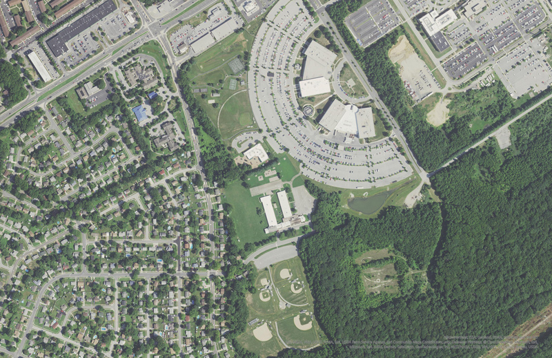
At their station, DeLiberty and Schorse created an activity where the students analyzed different scales of satellite images to highlight the beauty and power of satellite imagery as well as show how areas of Delaware have changed over time. One portion of the activity had the kids analyze satellite images of Middletown and identify how the community has changed over the last 20 years. Students also examined an aerial view of Dover and had to pick out the Dover Air Force Base and Air Command Mobility Museum.
Perhaps the kids’ favorite activity, however, was when they had to try to pick out their school from a set of aerial images which included all the schools in attendance.

“It was interesting to hear them talk about what features they remembered were around their schools,” said Schorse. “It was definitely a group effort to make sure they got the right answer, but it was a lot of fun to have them analyze the pictures. They would say, ‘This one is not our school because we have too many trees, and there’s all these different roads’ or ‘we have two baseball diamonds.’” Deliberty added that a few students shouted out when they saw their house.
Promoting geography at UD
Geography outreach isn’t just for students in kindergarten through 12th grade either. Every year, UD hosts an event for GIS Day in celebration of people using GIS to build applications that are making a difference in society. The event is also now organized with the State of Delaware.
DeLiberty gave opening remarks at the event, which featured talks on topics as diverse as mapping opioid overdose deaths and deforestation in Nigeria. The breadth of topics shows just how many different areas of study geography covers, as well as how many careers can be achieved through the use of geography. Participants at UD’s GIS Day include students and faculty, but also local GIS users from state and local agencies and private companies.
GIS Day is also where winners are announced for the UD Student Competition for Geospatial Data Visualization/Map Design, co-sponsored by the Department of Geography and Spatial Sciences with the UD Data Science Institute (DSI) and created by Jing Gao, assistant professor of geospatial data science.
This year’s competition had many submissions and resulted in one winner, one runner-up, and two honorable mentions, all of which received acknowledgement certificates and cash awards, and were featured on the competition's website and the DSI homepage.
Chenesia Brown, a doctoral candidate in the Department of Sociology and Criminal Justice at UD, was the winner of the competition for a map titled, “Unhoused Crisis Relative to Housing Inventory, U.S. Metropolitan Areas, 2020.”
Whether they’re conducting outreach activities at local schools or promoting noteworthy GIS achievements at UD and locally, DeLiberty said emphasizing the diversity of uses for the technology and the many professional opportunities available through studying geography is something she, Schorse and others always emphasize.
“We try to showcase the fact that there are these job opportunities and careers out there that the students don’t really know about,” said DeLiberty. “We try to get them excited about the things that we do with satellite imagery, and when the students all say ‘wow, that’s really neat’ and they get engaged with it, I think it’s so rewarding.”
Contact Us
Have a UDaily story idea?
Contact us at ocm@udel.edu
Members of the press
Contact us at 302-831-NEWS or visit the Media Relations website

