
Carolina Bays
Photos courtesy of Mark Lundine December 09, 2021
UD doctoral student uses computer neural networks to find unique geological feature on the Atlantic Coastal Plain
Along the Atlantic Coastal Plain, from southern New Jersey to northern Florida, you can find sandy-rimmed depressions known as Carolina Bays. The exact number of Carolina Bays, however, has always been a mystery and estimates have varied from 10,000 to 500,000. How these Carolina Bays formed is also a mystery.
There are some hypotheses that point to comets, meteors or glacial ice shards raining down on the East Coast thousands of years ago and creating the Carolina Bays on impact. More scientific hypotheses suggest the Carolina Bays were the product of natural wind and wave processes.
University of Delaware doctoral student Mark Lundine used publicly available Lidar data, which provides elevation information gathered by a technique called Light Detection and Ranging (LiDAR), to set up a series of convolutional neural networks (CNN) to find and map these Carolina Bays, finding 23,000 Carolina Bays in the area with different geological features depending on their location.
This research was recently published in the Remote Sensing scientific journal and demonstrates how CNNs can be valuable tools in finding geomorphic features across a landscape. Lundine worked with Art Trembanis, professor in the School of Marine Science and Policy, on the project and Trembanis is a co-author on the paper.
Lundine, a doctoral student studying oceanography in UD’s College of Earth, Ocean and Environment, said that these CNNs can be trained to detect any sort of object — including everyday objects like dogs and cats — and he used images of Lidar data which showed elevation and digital topography.
Gathering images of the topography of the coastal plain and selecting images from Delaware, Virginia, North Carolina, South Carolina and Georgia — both with and without Carolina Bays — Lundine was able to train the computer to detect the presence of Carolina Bays.
“I showed the computer what a Carolina Bay is a bunch of times, and it was able to come up with a series of computations to make a class label — in this case, a Carolina Bay — and a confidence level — for instance if it’s 90% sure it’s a Carolina Bay,” said Lundine. “Then the next time, I could show the computer a new image of a Carolina Bay, and it should be able to map that.”
After feeding the computer all the data from New Jersey to Northern Florida, the computer output all of the Carolina Bays that it found, Lundine filtered those results to only include the ones that were above a 60% confidence level threshold, which he found was a good threshold to maximize detections but minimize false positives.
After filtering out those false positives, Lundine was able to analyze the detected Carolina Bays with more detailed information on topography.
“I could analyze, what is the average depth of a Carolina Bay? What is the average area or diameter? And that can tell us a little bit more about, not only describing the Carolina Bays, but figuring out how much sediment was scoured out to build that depression and how far from the coast they are usually located,” said Lundine.
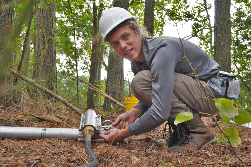
In addition to using the computer models, Lundine also did some field work, taking sediment samples and core samples from Carolina Bays in Delaware and Virginia.
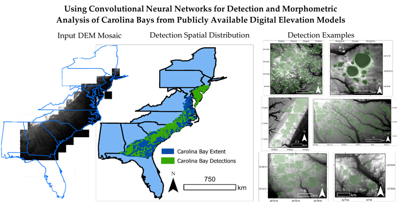
The findings showed that the highest density of Carolina Bays occur along interfluves, a ridge-like landform located between two valleys. Carolina Bays found in Delmarva were smaller than those found in the southeastern portion of the Atlantic Coastal Plain, with a third of the bays being converted to agricultural land and half of all bays being in forested areas.
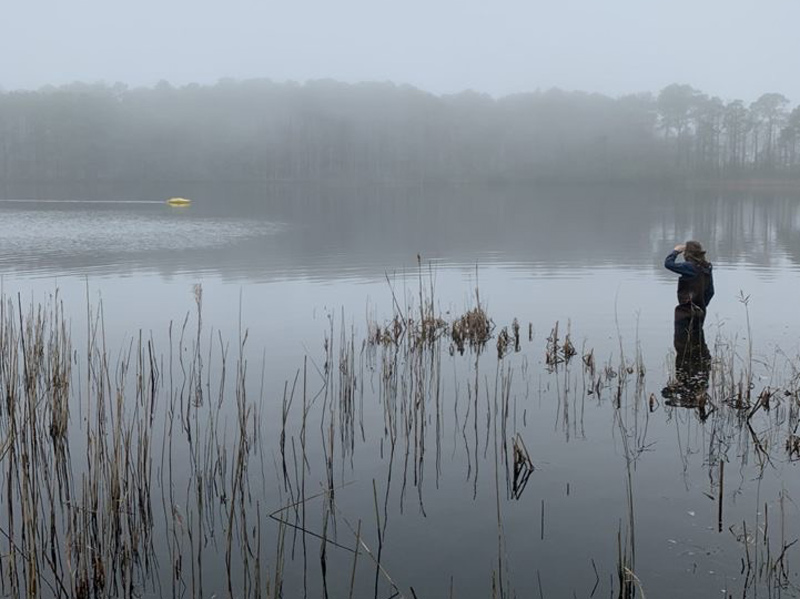
Almost all of the Carolina Bays were found to be within two kilometers of a water body.
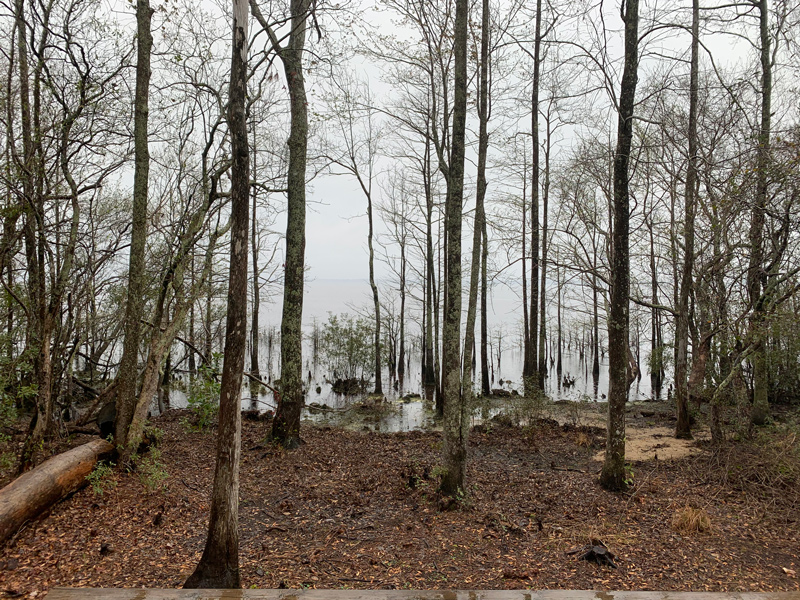
The field results showed that the Bays typically have 1.5- to 2.5-meter-thick sand rims that show a gradient of texture, with the coarser sand at the bottom and finer sand and silt toward the top. The basins were between 0.5 and 2 meters thick and had a mix of clay, silt and sand deposits. Lundine noted that the clay keeps water from seeping further into the ground, creating the seasonally filled ponds that are characteristic of Carolina Bays, which typically have the most water in early spring and can be completely dry later in the year.
Because of the uniformity of the Carolina Bays and their location on the coastal plain, typically on unconsolidated sand and not in environments with hard rock, Lundine said he thinks their formation is unlikely to have been caused by a big impact event.
“Meteors or comets, they don’t pick a specific substrate to hit,” said Lundine. “If there’s going to be a big impact event that affects the whole East Coast, it’s not just going to hit the coastal plain. We’d see evidence on every type of substrate it could have hit. I didn’t find anything that pointed anywhere close to any sort of impact event.”
Contact Us
Have a UDaily story idea?
Contact us at ocm@udel.edu
Members of the press
Contact us at mediarelations@udel.edu or visit the Media Relations website