
Mapping Bikini Atoll
Photos courtesy of Art Trembanis December 10, 2019
UD researchers involved in underwater mapping of the nuclear test sites in Pacific
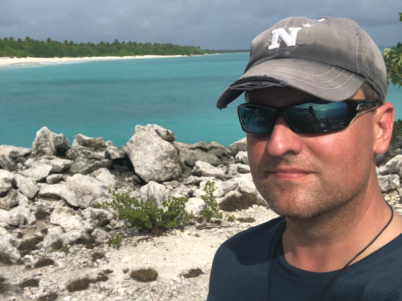
While standing on a small ship near Bikini Atoll in the Marshall Islands during the summer of 2019, University of Delaware Professor Art Trembanis looked up and realized that if he had been in that spot 73 years ago, he would have been engulfed in a humongous atomic mushroom cloud.
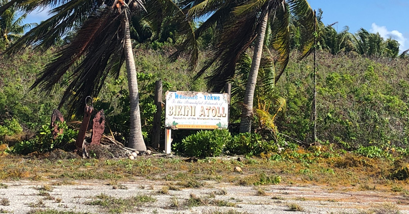
It was in that idyllic and, more importantly, remote central Pacific island that the United States conducted a series of nuclear weapons tests in the 1940s and 1950s that sunk warships, tanks and other vehicles as part of a simulated nuclear battlefield. Twelve wrecks, some of them as large as the passenger liner Titanic, now lie in the 180 foot-deep waters of Bikini Lagoon.
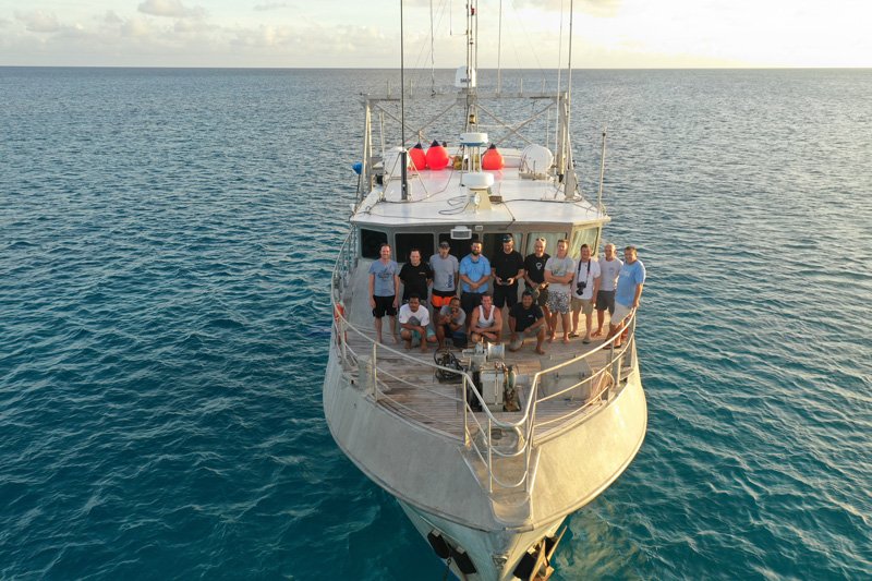
In June, Trembanis led a team tasked by SEARCH, a cultural resource management firm, with conducting an underwater mapping effort to locate and characterize the ghost fleet that sits on the bottom of the Pacific as well as the landscape of the atoll in general.
Trembanis, associate professor in UD’s College of Earth, Ocean and Environment, said that Bikini Atoll has been a fascinating subject for many oceanographers and he jumped at the chance to characterize the sunken ships.
“I think for all oceanographers, it’s a site that you immediately connect with and know about,” said Trembanis. “There are not many places you can go and try to map something in a unique way. This was definitely the case here. There are just so many shipwrecks, and each one is different.”
Previous mapping effort
The work done by the team is a first-ever detailed look at the simulated nuclear battlefield at the bottom of Bikini Lagoon. It builds on data initially collected by the U.S. Navy in 1946-1947, and by a team led by the U.S. National Park Service, which worked with the Navy and the U.S. Department of Energy in 1989-1990 to relocate and map the wrecks, work documented by archaeologist James Delgado, now senior vice president of SEARCH.
“While our maps were good, and based on many long hours in the water, they were not enough,” Delgado said. “We needed a more accurate map that could only be done when sonar and survey technology caught up with our needs as scientists.”
When an opportunity arose to go to Bikini to reassess the wrecks, Delgado and Michael Brennan, a maritime archeologist with SEARCH, knew that Trembanis and his team at the University were the right people for the task. They reached out to ask if Trembanis would lead the mapping effort for the study. Trembanis, who knew Delgado’s work through the archaeologist’s book Ghost Fleet: The Sunken Ships of Bikini Atoll, was eager to join the effort.
To help with the work, Trembanis recruited Carter DuVal, who received his doctorate from UD and is now a postdoc at the Naval Research Laboratories Stennis Space Center, and Grant Otto, who graduated from UD in 2018 and now works in Trembanis’ lab as an engineering technician and field specialist. Their role was to provide the overall data points for the locations of the ships on the seafloor, as well as to take into account how the seafloor itself and the craters left by the explosions may have changed over the years.
Brennan said that having worked with Trembanis and DuVal on prior projects, he knew the expertise and professionalism they could bring to the mapping effort.
“I knew that they were a team that could deliver what we needed and they certainly did,” said Brennan. “We ended up with a fantastic landscape map of Bikini and the team delivered on what we needed to get done.”
Searching with sonar
Though the 1989-1990 effort produced a breadth of information, it was limited because it only had a dive team that couldn’t explore the far reaches of the ocean floor and weren’t sure of the exact locations of some of the underwater targets. In addition, sonar technology and modern techniques and equipment had not been an option for the team three decades ago.
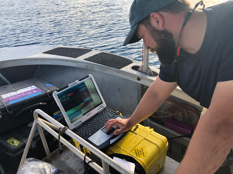
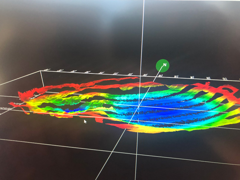
Using sonar that provided three-dimensional scans of the seafloor as they moved, Brennan, Trembanis and the team swept large swaths of the seafloor to get the general outline of the ships and other marine debris. Trembanis said they were able to map an overall view of the area in about a day and a half at the beginning of the research, work that Delgado said was especially important.
“In short order, the team produced a detailed, three-dimensional map of the simulated nuclear battlefield, with every ship accurately pinpointed,” Delgado said. “This is the largest undersea battlefield surveyed and mapped, and it is a game changer in assessing major events that have left a profound footprint on the seafloor. What Art and the team have done is given the world its first-ever look beneath the sea into the heart of an atomic explosion and its aftermath.”
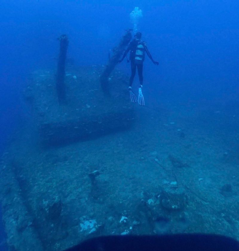
At Bikini, Trembanis and Brennan then directed the expedition dive team that they worked with to the exact locations of certain targets for follow up work and photography.
“We sort of did the advance scouting,” said Trembanis. “We’d find, ‘Ok, here’s where the ship is. Here’s the bow, here’s the stern, here’s where you want to focus.’ ”
Remote Area
One of the difficulties of working in an area as remote as Bikini was that the team members had to figure out how to rig their sonar equipment to a boat that they had only seen through pictures.
“I had to build the mount for the boat’s sonar that we used based on a few pictures that we had,” said Otto. “We came up with ideas to make a few things prefabricated as much as we could and then have a few adjustable parts. It was definitely a different challenge.”
In addition, the team had to bring Geiger counters along with them and wear dosimeters to ensure that they were not being exposed to dangerous levels of radiation. All of the researchers were fine, but there are still lingering issues on the island because of radiation and the native Bikinians who were displaced before the tests are still not allowed to move back to their homes yet.
Getting to the area took six days. Several flights were required to get the team to Majuro, which is more than 2,000 miles southwest of Hawaii. Then there was a 60-hour ride on a boat to Bikini.
DuVal said that the team worked well together to overcome the obstacles involved in bringing equipment halfway around the world.
“If you had pulled anybody out of this team, we probably wouldn’t have had the success that we had,” said DuVal. “That’s the way you want it. We got a good crew together and were able to get good data because of it.”
Trembanis credited the work of DuVal and Otto with allowing them to get such high-quality data.
“They not only had to operate the sonar and gather the data, but we were processing it in real time,” said Trembanis. “We knew we pretty much had one shot at this, and they did such a remarkable job.”
Operation Crossroads
Trembanis said that as soon as the team arrived, they began mapping the site of Operation Crossroads, which was a pair of nuclear weapon tests — known as Able and Baker — conducted in July 1946, and getting a detailed map of the wrecks. In Test Able, the weapon was dropped from a B-29 bomber and exploded above the water, according to a U.S. Department of Energy website that explains the history of the Manhattan Project. In Test Baker, the weapon was detonated 90-feet below the surface.
“There was very much an interest in doing detailed work on a subset of the ships, but if you’re going to focus on the trees, you have to know the layout of the forest,” said Trembanis. “Nobody had done that before so that was exciting and new.”
Brennan was interested to see how the ships were oriented in relation to each other and to see if the crater left by Test Baker was still visible or if it had been filled in. He said he was surprised to learn the crater was still prominent, rather than filled in by sediment over the last 70 years.
The Japanese cruiser Sakawa, sunk during Test Able and blasted into the seabed by Test Baker, had sunk so far into the seafloor that the earlier dive team completely passed it over. Using the sonar system, however, the researchers were able to pick it up.
All of the researchers agreed that they would love to go back and explore more of the smaller targets on the seafloor that they didn’t have the time to investigate further: anchors used to hold target ships in place and the test equipment, military vehicles and aircraft placed on the ships to see what the effects of atomic weapons would be.
“When people think of that photo with the mushroom cloud, that’s where we were. You see how dwarfed these massive ships were by that blast,” said Trembanis. “In many ways, I was struck by it being this idyllic, beautiful Pacific island and I thought ‘This was the site of the most violent explosions on the planet.’ It’s still very much a puzzle, and we’d love to be able to go back.”
Contact Us
Have a UDaily story idea?
Contact us at ocm@udel.edu
Members of the press
Contact us at mediarelations@udel.edu or visit the Media Relations website