
Sturgeon warning system
Photos courtesy of Delaware State University May 06, 2021
New tool allows UD researchers to inform local fishers, resource managers on avoiding the endangered species
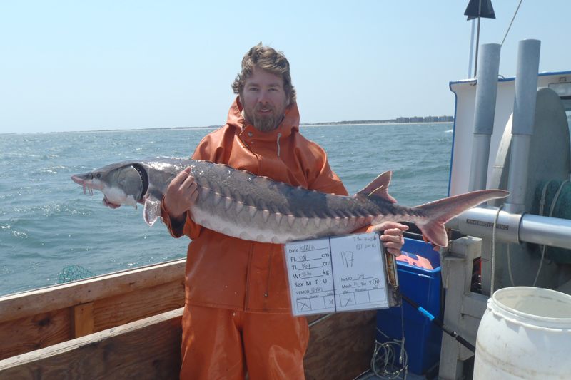
University of Delaware postdoctoral researcher Matthew Breece has dedicated much of his time since 2009 to the study of Atlantic sturgeon in the Delaware River Estuary and off the coast of Delaware — tagging them and using telemetry to gather data on where the fish were going in the bay, as well as the habitats they were using as they migrated with the changing seasons.
This work allowed Breece and Matthew Oliver, Patricia and Charles Robertson Professor of Marine Science and Policy in the College of Earth, Ocean, and Environment, to develop a text alert system to help fishers avoid Atlantic sturgeon, which are accidentally caught when commercial fishers search for other species. These texts tell fishers in what areas of the Delaware Bay and at what water depths Atlantic sturgeon are most likely to be found, allowing them to avoid the vulnerable species when targeting other fish.
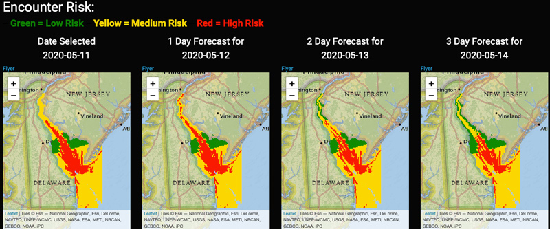
Now, Breece and a team of collaborators from UD, Delaware State University (DSU), Delaware Sea Grant and the Delaware Department of Natural Resources and Environmental Control (DNREC), have developed a forecasting tool for local fishers and natural resources managers that will inform them not only where Atlantic sturgeon are currently located in the Delaware Bay but also provide them with a three-day forecast highlighting where they will be in the future.
The results of this research were recently published in the Ecological Applications scientific journal.
Historical work
Breece’s work with Atlantic sturgeon began in the early 2000s when he took a summer job at an aquaculture center that was raising Atlantic sturgeon for the state of Maryland.
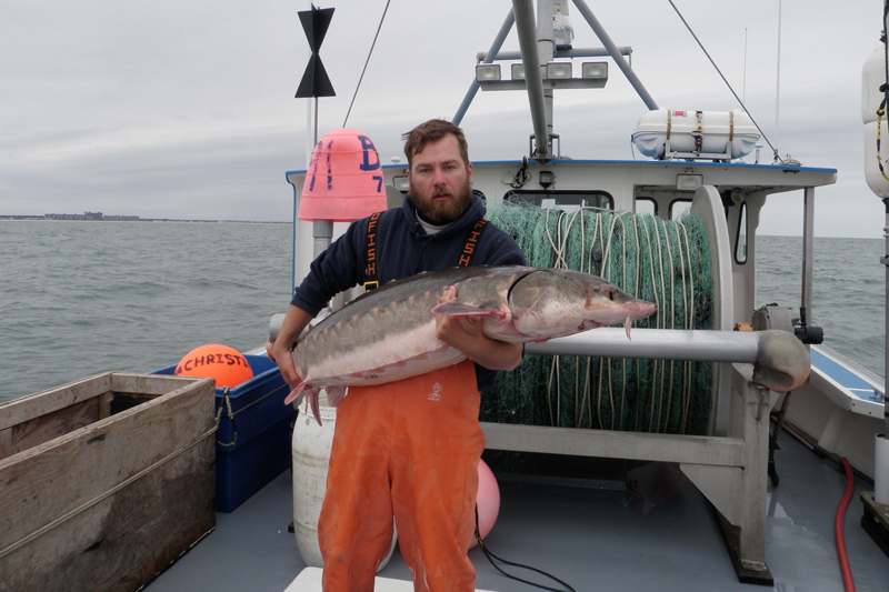
He explained that Atlantic sturgeon, which can grow up to 800 pounds and have been listed as an endangered or threatened species since 2012, were once a huge fishery in the Eastern Seaboard of the United States with the Delaware River supporting large commercial fisheries in the late 19th and early 20th centuries.
Due to overfishing and poor water quality in spawning rivers, their populations plummeted.
“There were thought to be around 180,000 females in the river every year,” said Breece. “Now, there’s thought to be around 300 females in the river every year. It’s a really drastic difference in population size.”
After working with the U.S. Fish and Wildlife Service, Breece started his master’s degree at Delaware State University in 2009 and worked with Dewayne Fox, professor at DSU, looking at Atlantic sturgeon movements in the Delaware River. He began collecting data that would ultimately help with this current project.
Breece continued to research Atlantic sturgeon while getting his doctorate at UD, where he worked with Oliver. He first conducted research that linked Atlantic sturgeon occurrence to four environmental variables: sea surface temperature, ocean color as received from satellites, the depth of Atlantic sturgeon occurrence, and the day of year.
Filling in Gaps
Though this data was able to give the researchers a good picture of the Atlantic sturgeon, they did run into some problems.
“One of the main issues we had with this was that the satellite data — which is the sea-surface temperature and ocean color — on a daily basis, has a lot of gaps in it,” said Breece. “There’s also a lot of clouds so you can’t really estimate the surface conditions of the ocean or the Delaware Bay.”
To help close these gaps, Breece utilized a gap-filling algorithm known as the Data Interpolating Empirical Orthogonal Functions (DINEOF).
Connecting the Atlantic sturgeon research model developed during the first part of Breece’s doctoral work to the DINEOF output, the research team found that it could correctly predict Atlantic sturgeon telemetry occurrences over 90% of the time within a three-day forecast.
“That was a great result. Now that we had a forecast, now that we had those estimates of Atlantic sturgeon occurrence given the environmental conditions in the Delaware Bay, we wanted to use that data to help reduce interactions with Atlantic sturgeon,” said Breece. “So we started working with commercial fisheries in the Delaware Bay and state level managers.”
While a similar framework has been utilized to forecast harmful algal blooms, to Breece’s knowledge, this is the first time a species distribution model has been applied to DINEOF gap-filled data to produce a forecast product for fish.
Understanding fishing operations
To understand the regulatory and operational needs of the commercial fishers, Breece said that Ed Hale, Delaware Sea Grant Marine Advisory Specialist and an assistant professor at UD, was crucial in getting feedback from the fishers and state level managers. The team also held a series of informal meetings and phone calls with DNREC and local commercial fishers and attended and presented at three Atlantic States Marine Fisheries Council meetings where bycatch was discussed to get community feedback and information.
Ultimately, the information was packed into an online tool that produces a forecast of Atlantic sturgeon occurrence for the current date, as well as three days into the future.
The areas covered in the tool include five regions: the Delaware River, Upper Delaware Bay, Middle Delaware Bay, Lower Delaware Bay and the Atlantic Ocean. Each of those areas is divided into five-meter depth bins. The tool is also color-coded with green signifying a low risk of encountering a mature Atlantic sturgeon, yellow signifying a medium risk and red showing a high risk.
At the end of February, they held an informational workshop on the tool to get users up to speed.
There are multiple channels to access the information produced by the tool. An automated system creates and distributes these risk maps to subscribers’ mobile devices, highlighting areas that should be avoided to reduce interactions, and an interactive web interface allows users to plot historic, current, future, and climatological risk maps as well as the underlying model output of Atlantic sturgeon occurrence.
Oliver said that the project is a great example of how historic data can be put to a productive use, crediting Breece for the work he conducted, both before and during his time at UD, that allowed them to develop their current predictive model.
“Matt [Breece] did most of the real detailed work on this. I was in a supervisory role, sort of nursing it along and trying to make sure it was supported, but our model couldn’t just be about just any animal. It’s because we have a lot of data on sturgeon,” said Oliver. “So it’s not just an exercise in making sturgeon predictions but also in general, can we predict where organisms go in the ocean? Which is a really hard problem to solve and so that’s how we attacked it. We’re hoping that this is an example of how to move forward especially with an endangered species like the Atlantic sturgeon.”
Funding and support for the project was provided by the Lenfest Ocean Program, a NASA Earth Science Applications: Ecological Forecasting Program Grant, the National Oceanic and Atmospheric Administration (NOAA) Joint Polar Satellite System Proving Ground and Risk Reduction Program; DNREC and the Mid-Atlantic Regional Association Coastal Ocean Observing System (MARACOOS).
Contact Us
Have a UDaily story idea?
Contact us at ocm@udel.edu
Members of the press
Contact us at mediarelations@udel.edu or visit the Media Relations website