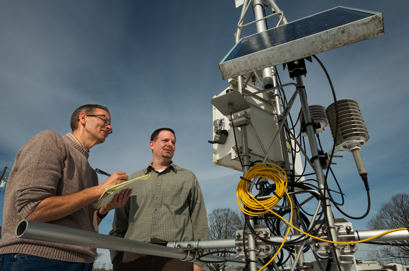


Extreme Weather Training
Photo by Kathy F. Atkinson October 25, 2018
UD experts explain latest weather technologies to Delaware emergency managers
Americans are obsessed with the weather. In the morning, we check apps on our phones, read digital displays of data from personal weather stations outside our homes, or at least hear weather reports on TV or radio as we prepare and head in to work.
But while most of us are just wondering how warmly to dress, especially in this unpredictable fall season, some professionals in Delaware have much more on their minds when they keep a close eye on the weather. Throughout the year, our state is vulnerable to the full range of weather-related hazards, from flooding and occasional heavy snows to drought.
The Delaware Emergency Management Agency (DEMA) monitors weather conditions and forecasts to plan and respond to any kind of hazard, and to do so, its staff members rely on information, tools and advice from University of Delaware experts. This fall, DEMA employees were trained in new and existing tools by staff from the Delaware Geological Survey (DGS) and the Center for Environmental Monitoring and Analysis (CEMA), both part of UD’s College of Earth, Ocean and Environment.
During the day-long session, DEMA staff learned about the latest technology that University experts are creating and employing to help keep those managers up-to-date in the case of extreme weather events including a new one-stop shop for learning about weather hazards.
Helping Emergency Managers Understand Data Collection
DGS Director David Wunsch, who is also the state geologist, said that the day allowed both new and experienced DEMA officials to learn how DGS and CEMA go about collecting and analyzing data throughout the state.
DGS monitors the state’s seismic network and calculates a drought index based on stream flows, reservoir capacities and groundwater levels. CEMA collects snowfall data in real-time and relays that information to the Delaware Department of Transportation, and another joint DGS-CEMA project that provides robust flood monitoring and risk prediction.
UD Professor and State Climatologist Dan Leathers, who is the director of CEMA, said the training was also to bring the personnel up to speed on the types of natural hazard events Delaware has to worry about, such as coastal storms, tropical systems and earthquakes.
“They’ve had some turnover so there are some new people who don’t know about the natural hazards, and they might not know about the tools we provide,” Leathers said.
New Delaware Weather Hazard Index Provided
CEMA shared its new Delaware Weather Hazard Index (DWHI), which went operational in the summer. The Index uses data collected from the National Weather Service, the Delaware Environmental Observing System and the National Ocean Service’s Delaware Bay Operational Forecast System to show emergency managers throughout the state hazardous weather condition risks such as rainfall, tornado or coastal water levels, over a 48-hour period, a timeframe CEMA chose based on feedback from the emergency management community.
The goal behind the DWHI is to have a one-stop shop for emergency managers throughout the state to be able to assess particular weather risks. Instead of having to go through various individual maps, like a temperature map or a rainfall map, this index has all of the information in one place with three colors to indicate the severity of risks: yellow for low risk, orange for moderate and red for extreme.
New Approach to Training
Whereas in the past DGS and CEMA representatives travelled to various county offices and trained small groups on specific tools, this was the first real all-encompassing information session where DEMA officials came to UD and got to see all of the tools firsthand. The training day was organized by Kevin Brinson, associate state climatologist with CEMA, and John Callahan, associate scientist and climatologist at DGS, as well as Christopher Hughes, applications developer for CEMA.
Wunsch said that it was good for the specific officials to see all of the tools as many of them are specialized in their fields and this gave them exposure to multiple types of natural hazards and a historical perspective of big storms.
DGS has historical storm information on how much the water level rose in particular streams during past storm events and the overall effect of particular storms.
“I think that helped them to understand that sometimes, hurricanes can behave differently and sometimes just a large severe thunderstorm dumping rain can be a bigger threat in this particular valley than a widespread storm,” said Wunsch. “Putting that big picture out there helped them to understand and interrelate all the different aspects of natural hazards.”
Contact Us
Have a UDaily story idea?
Contact us at ocm@udel.edu
Members of the press
Contact us at 302-831-NEWS or visit the Media Relations website

