
Environmental sensing symposium
Photo by Michael Graw January 26, 2018
Experts gather at UD to discuss environmental monitoring in Delaware
Whether we know it or not, we all depend on environmental data in our daily lives.
When we listen to the radio to learn whether school is closed due to snow or if rain or flooding challenges will affect our morning commute, it is environmental data, coupled with informed decision-making, that provides the answer.
Farmers use environmental data to know when to irrigate crops and monitor for disease or drought, while water quality experts use it to ensure a safe water supply.
And while most of us only want to know the simple things, like “is my water safe?” or “am I going to be late to work?”, behind the scenes, scientists, emergency planners, state agencies, energy utilities and others are constantly evaluating what data are available, how the data is being used and what else is needed to maintain the highest quality of life and economic vitality for the state of Delaware.
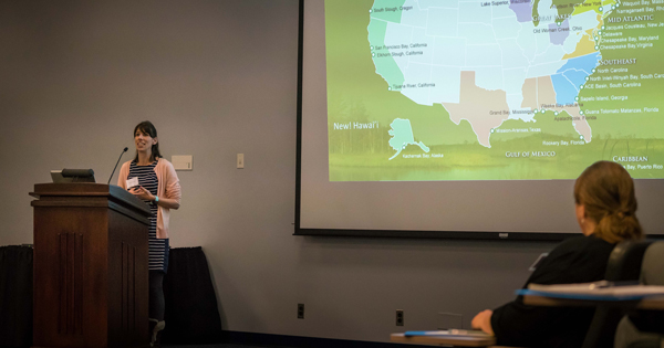
Nearly 60 experts gathered at University of Delaware’s John M. Clayton Hall on Wednesday, Jan. 17 to discuss environmental monitoring in the First State at the Delaware Environmental Sensing symposium.
Led by UD’s Center for Environmental Monitoring and Analysis (CEMA) and sponsored by the Delaware Department of Natural Resources and Environmental Control’s Coastal Programs, the symposium served to develop a mechanism to coordinate future efforts in the state to better serve the broader environmental community.
“We are fortunate to have the resources we do here on UD’s campus and statewide to gather information that enables us to better serve the residents of Delaware,” said UD Interim Provost Robin Morgan in opening remarks. “We live hard on this fragile land, and we need to take care of it. Monitoring is needed to help preserve it.”
One important task was to identify gaps and overlaps, including where groups could work together more efficiently.
“The idea is to get people talking, about the things we are doing well, or the areas we can improve or collaborate to make Delaware an example of what can be done with intense monitoring,” said Dan Leathers, who leads CEMA and is the State Climatologist for Delaware.
Collaborating to improve quality, coverage and resources
Extreme climate variability is one of the grand challenges of our time, with recent weather-related disasters—including hurricanes Harvey, Irma, Jose and Maria, not to mention devastating wildfires in California and elsewhere—underscoring the importance of environmental monitoring and sensing data to understand and mitigate these disasters.
CEMA is a statewide resource housed at UD that collects and integrates various types of environmental, atmospheric and remote sensing data into tools and products that provide both access to comprehensive, high-quality information and support for making decisions based on it. Such information and support improve Delaware’s resiliency to future significant weather and flood events, while also informing planning efforts for everything from infrastructure to emergency management.
CEMA runs projects in four main areas that together make these services possible. It collects surface observations from the Delaware Environmental Observing System (DEOS), which provides the foundation of real-time data on which other work builds. CEMA’s Delaware Environmental Monitoring and Analysis Center, an EPSCoR-funded project, provides data analysis and integration, then builds tools like online interfaces and decision-support tools. CEMA also coordinates the University’s satellite receiving station for remote sensing data and provides weather and climate outreach and expertise through the Office of the Delaware State Climatologist.
“Our four programs monitor the environment and use environmental data to create decision support systems and tools that the state of Delaware, agencies and the general public can use to solve problems,” said Leathers.
DEOS, for example, operates the highest resolution statewide meteorological network in the U.S., with 57 total weather stations, including 44 stations in Delaware, 11 in Pennsylvania and two in Maryland. These data are used to calculate snow totals used in National Weather Service reporting and by the Delaware Department of Transportation for reimbursing civic associations for snow removal, among other things.
Estella Atekwana, dean of the College of Earth, Ocean, and Environment (CEOE) where CEMA is housed, told attendees of the symposium, “As a scientist, I understand the vital role that the data you collect plays in research and decision-making. CEOE and UD are committed to supporting innovation and entrepreneurship in the area of sensor development and data analytics and science because with our ability to acquire big data comes the need for data analysis for timely decision making.”
CEOE has a statewide footprint in environmental monitoring, research and public engagement unlike any other institution in Delaware. It is the administrative home of not only CEMA, but also Delaware Geological Survey, which provides essential information on surface and groundwater conditions throughout Delaware, and Delaware Sea Grant, which focuses on conservation and management of marine and coastal resources.
On the leading edge of environmental monitoring
Delaware is considered one of the most well monitored states in the U.S., according to Kari St. Laurent, research coordinator for DNREC Coastal Programs and one of the speakers at the symposium.
Having data that is comprehensive, understandable and accessible does more than simply inform scientists, policymakers or planners, it also can help the public understand where money is being spent and how it is helping to affect and change lives.
“Flood monitoring data, for example, that’s going to be potentially lifesaving,” St. Laurent said. “We are low-lying and we flood a lot, so understanding what happened [during past events] is really important for predicting what will happen in the future.”
Gene Donaldson, operations manager for DelDOT’s Transportation Management Center, said he relies heavily on data from thousands of real-time environmental sensors throughout the state to do his job. He recognized many of the faces in the room as partners and colleagues, and said he looked forward to meeting those he didn’t know.
In some ways, that was a primary goal of the symposium and one of the things CEMA routinely does on a more informal basis, according to Leathers. Because CEMA works with so many different state agencies, nonprofits, and academic institutions, Leathers’ team connects different collectors and users of environmental data to ensure the people who need it are getting the best information available.
“Trying to create a cohesive approach to monitoring the state makes our work more effective,” Leathers said. “I want to keep us highly involved and emphasize the role CEMA can play in coordinating and facilitating the work of all of our peers and stakeholders statewide.”
Special thanks to Kevin Brinson and Tina Callahan for helping to coordinate the symposium.
Contact Us
Have a UDaily story idea?
Contact us at ocm@udel.edu
Members of the press
Contact us at mediarelations@udel.edu or visit the Media Relations website