
Subsurface phosphorus
August 16, 2017
UD study looks to clean up subsurface phosphorus risk assessment
When it comes to advancing nutrient management planning for croplands across the United States, it is important to evaluate phosphorus indices to ensure accurate phosphorus loss risk assessment.
Until recently, however, most of these phosphorus index assessments have focused on the risks of phosphorus losses in surface runoff while inadequately taking into account the critical role of subsurface phosphorus losses.
This is particularly important in areas such as the Atlantic Coastal Plain, where subsurface flow is the predominant pathway of phosphorus transport from artificially drained agroecosystems — cropland that uses artificial drainage to lower water tables.
A new paper published in the Journal of Environmental Quality by researchers from the University of Delaware and other contributing institutions explores methods to evaluate the subsurface phosphorus risk routines of five phosphorus indices from Delaware, Maryland, Virginia and North Carolina using available water quality and soil datasets.
The research was funded in part by a United States Department of Agriculture (USDA) Natural Resources Conservation Service Conservation Innovation Grant.
Amy Shober, associate professor in the Department of Plant and Soil Sciences and a Cooperative Extension specialist, is the lead author on the paper, which represents some of the work done by Kathryn Turner, who worked in Shober’s lab and graduated from UD in 2016.
Co-authors include Scott Andres, hydrogeologist and senior scientist with the Delaware Geological Survey, Anthony Buda, U.S. Department of Agriculture, Thomas Sims, a retired UD faculty member and former deputy dean of the College of Agriculture and Natural Resources, Nicole Fiorellino, Chesapeake College, and Joshua McGrath, University of Kentucky.
Atlantic Coastal Plain
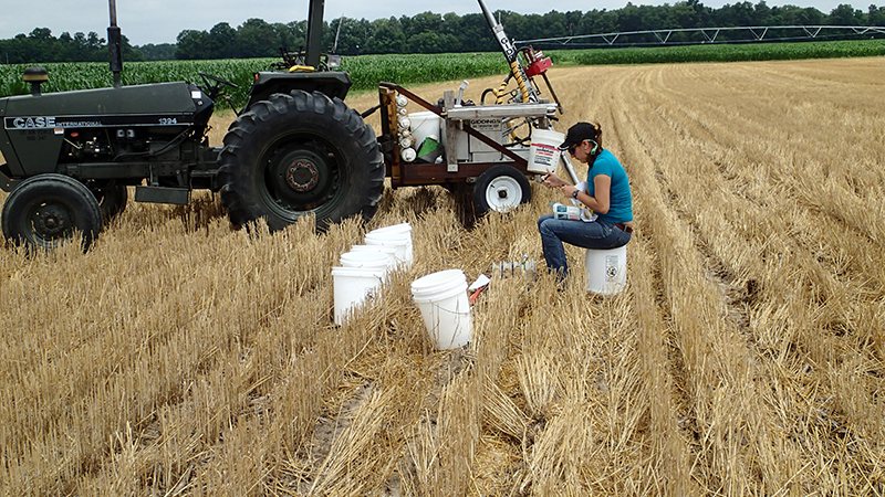
Shober said that some cropland on the Atlantic Coastal Plain must be artificially drained to lower the water table in order to avoid having water within the root zone of plants or standing water in their fields, which would disrupt farmers’ ability to use equipment and plant successful crops.
Shober said that today’s farmers are dealing with what is known as “legacy phosphorus,” phosphorus that is left over from past manure applications and that continues to contribute to water quality issues.
Using phosphorus indices, farmers and land managers can identify areas in the landscape where phosphorus sources overlap with the ways in which water moves phosphorus through the soils.
There have been a lot of studies evaluating the risk of phosphorus transport, such as erosion and surface runoff, because these losses are easily seen. Fewer studies have been conducted on the contributions of subsurface phosphorus to drainage waters, which are harder to track because they occur below ground and there are fewer tools to study these losses.
“You can collect runoff at the end of the field and know what came over that land surface,” said Shober. “It’s harder to identify where water moving through the ditch network originated. Water draining from the fields occurs underground, and the discharges from multiple fields mix as water moves through the ditch network. Not to mention that rainfall that is directly deposited to the ditch — and even overland flow — can also contribute to ditch flow.”
Soil data
To better study the subsurface phosphorus sources and transport, the researchers started looking at soil data to determine if the previously existing phosphorus index models were able to accurately predict subsurface phosphorus sources and transport. They found that the pre-existing hydrologic models to evaluate subsurface phosphorus were inadequate when it came to evaluating flat, artificially drained areas like those found in the Mid-Atlantic Coastal Plain.
For flat landscapes, the hydrologic models didn’t work because they need slope and are based on topography. Because the Mid-Atlantic Coastal Plain doesn’t have a lot of surface runoff but instead has a lot of subsurface runoff, the models were calculating for problems for which the model was not designed.
“There aren’t a lot of studies, especially in our region where it’s flat and there is a lot of ditch drainage, so we can’t calibrate and verify our phosphorus indices for subsurface phosphorus losses,” said Shober. “We started looking to see if we could use soil data to determine if we were going in the right direction. If we were really seeing high phosphorus risk in places where this index is identifying high subsurface losses.”
Shober said that the researchers were able to conduct this study using previously collected soils, which can be stored for long periods of time and still contain measurable phosphorus.
Subsurface phosphorus index
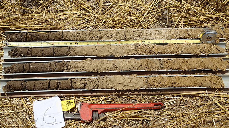
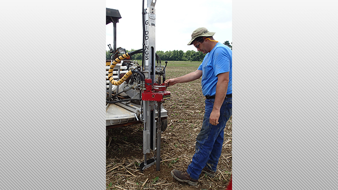
Using a library of soil cores that the authors had collected at different depths from all over the Delmarva Peninsula and using data collected by Sims and Andres, the researchers calculated the risk for subsurface phosphorus loss using five phosphorus indices. They looked at the phosphorus index scores without taking into account any manure application, only concerning themselves with contributions of the legacy phosphorus.
“For our index, we eliminated the things that we weren’t interested in looking at so we ultimately got a score that we consider was just for this subsurface risk,” said Shober. “We wanted to say, ‘OK, what is the inherent risk of subsurface losses of phosphorus that was in the soil?’”
Once they got those numbers, they looked at the water-extractable phosphorus at the depth of the seasonal high water table and correlated the data to see the relationship.
To find the water-extractable phosphorus, the researchers took a small amount soil and a little bit of de-ionized water and shook them for an hour and measured how much phosphorus came out of the soil.
“If the phosphorus index subsurface score was low and the water-extractable phosphorus in the soil at the depth of the water table was low, we would expect a low risk of subsurface phosphorus losses. So, ultimately, we wanted to see scores increasing either linearly or exponentially as soil water extractable phosphorus increased – the higher the risk score, the higher the water-extractable phosphorus level should be,” said Shober.
The calculation using water extractable phosphorus concentrations at depths corresponding with the seasonal high water table could serve as a realistic proxy for subsurface losses in ditch drainage and as a valuable metric that offers interim insight into the directionality of subsurface phosphorus risk scores when water quality data are inaccessible.
This will all help to improve monitoring and modeling of subsurface phosphorus losses and enhance the rigor of phosphorus index appraisals, Shober said, adding, “We’re hoping that this is something that people can do to move forward with our understanding of subsurface phosphorus loss. In the end, we ended up making some small tweaks to both the Maryland phosphorus management tool (PMT) and the North Carolina phosphorus loss assessment tool (PLAT) that made them score more appropriately against our soils dataset.”
Contact Us
Have a UDaily story idea?
Contact us at ocm@udel.edu
Members of the press
Contact us at 302-831-NEWS or visit the Media Relations website


