

Searching for 'The Goonies’ pirate ship
Photos courtesy of Art Trembanis July 15, 2022
UD assists in the search for wreck of a Spanish galleon off the coast of Oregon
The Santo Cristo de Burgos was a Spanish galleon that sailed from the Philippines in 1693, crossing the Pacific Ocean toward Acapulco, Mexico, loaded with goods for trade such as porcelain, silk and beeswax. Unfortunately, the ship wrecked along the Oregon coast.
Known colloquially as the Beeswax Shipwreck, the ship found fame in the 1980s as the inspiration for One-Eyed Willy’s pirate ship in Steven Spielberg’s film, The Goonies. But while the ship may have found widespread popularity thanks to the silver screen, its location on the bottom of the sea has so far remained a mystery.
When a dozen timbers thought to be from the Santo Cristo de Burgos were found trapped in tide pools and sea caves on the northern coast of Oregon earlier this summer, interest in conducting a widespread search for the wreck was renewed.
For a week in June, University of Delaware professor Art Trembanis and members of his lab joined SEARCH2O, the maritime archeology branch of SEARCH Inc., to conduct underwater mapping of possible locations of the ship off the coast of Oregon. The groups were supported by the National Geographic Society and also had assistance from the Maritime Archaeological Society, which have conducted research and field work on the area for the past two decades, the Columbia River Maritime Museum, Oregon State Parks, the State Historic Preservation Office, and coastal first responders. That team largely focused on the high-stakes rescue of the timbers from the often hazardous caves and tide pools.

For Trembanis, who grew up in the Pacific Northwest, the opportunity to look for The Goonies wreck was too good to pass up.
“From a personal standpoint, I grew up here in the northwest, and this is an area I would come to in the summers. It’s where they filmed The Goonies,” said Trembanis, professor in the School of Marine Science and Policy. “Our team, the UD squad, was brought into this project to map the seafloor and try to find where the material from the shipwreck is coming from.”
The UD team included Grant Otto and Sun Woo Park, both masters’ students in the School of Marine Science and Policy, and Hunter Tipton, who received his masters from UD and now works as a marine technician in Trembanis’ lab.
Park said that it was great to be a part of the research team and a valuable learning experience.
“Both Hunter and Grant have more experience in the field than I do. Watching how they work on the boat helped me learn the ropes really quickly,” said Park. “The same equipment and methods used to look for the shipwreck can also be applied to other research, like looking at sediment properties which is my personal interest. Learning the practical operations was really helpful in getting a feel for data collection and meeting all the people from different backgrounds that came together for the project was very interesting.”
They were invited by James Delgado, senior vice president for SEARCH Inc., with whom Trembanis has worked on many projects, such as looking for wreckage in Bikini Atoll and searching for the USS Nina.
“We knew from those projects that Art was bringing more than the tech — he was bringing his professional focus in coastal geomorphology, and he was (and is) no stranger to shipwrecks,” said Delgado. “None of this could have happened without the involvement, the experience, the professional expertise, academic excellence, and team work that Art and his team brought to the project.”
Shipwreck homework
Surveying an underwater shipwreck poses its challenges anywhere in the world, and searching for a Spanish galleon from 1693 on the rugged Oregon coast was no exception.
“This can be a really difficult place to work. There are waves that come and slam against the shoreline. It's rugged, it’s rocky and it’s high-energy surf. It’s beautiful but it’s also, at times, even on the calmest days, really fierce,” said Trembanis. “We had to get familiar with the weather and sea conditions, and we had to get familiar with a boat that we hadn’t worked on or seen before, which is always a bit of a challenge.”

Even before arriving in Oregon, Trembanis and his lab members had to gather all their equipment, pack it up and ship it from Delaware to the Maritime Museum in Astoria, Oregon. In addition, they had to find a boat that would be able to take them out on the water once they actually arrived.
The team found a fishing vessel known as the Spindrift they could use for their research cruises. To properly survey the areas where the 1693 shipwreck was thought to be, the UD team had to first test out their equipment in the area. To do that, they looked at a known shipwreck from 1983 that had been mapped in 2010 by the National Oceanic and Atmospheric Administration.
Using their equipment, the UD team was able to verify whether the wreck was still there, and see if there had been any movement or change in the condition of the wreck.
“When we mapped it, we found that it’s still in the exact same spot that the 2010 survey showed it to be, but it is severely, significantly, more deteriorated,” said Trembanis. “So if we see what has happened to a modern, steel shipwreck in 39 years, that gives us some indications and it helps us infer what may have happened to a wooden ship from 328 years ago.”

Having tested and gotten comfortable with the area, the boat and their equipment, they were ready to look at certain promising sites where the Santo Cristo de Burgos was thought to be.
While for centuries, there has been land-based evidence of a wreck, there has only been limited search efforts offshore by local fisherman and archeological groups.
“The search area for this wreck is a dynamic and challenging one for a host of reasons, from weather to the close proximity to the shoreline,” said Otto. “Collecting high-quality data in that environment was pretty tough, and we were lucky to have a great captain who knew the conditions and could position the boat in tight quarters so we could do our jobs to the best of our ability.”
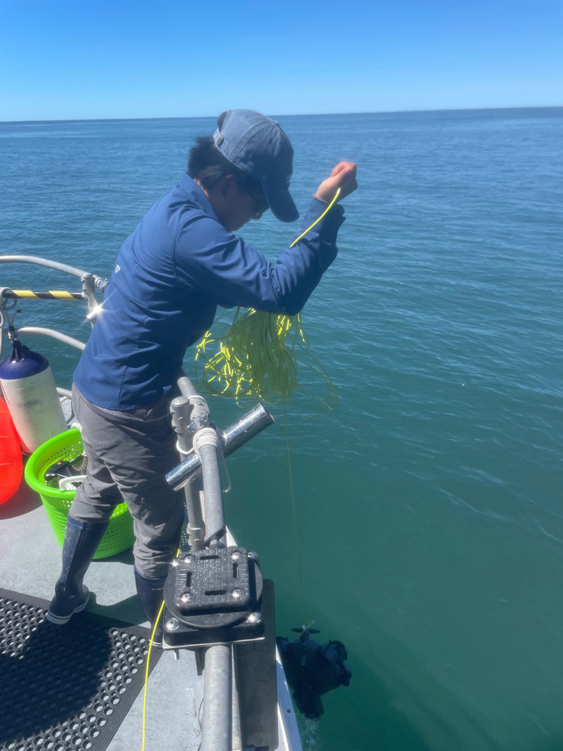
Trembanis and his lab members were able to use state-of-the-art technologies such as multi-beam echo sounders, autonomous underwater vehicle (AUV), and remotely operated vehicle (ROV) systems to map, explore and systematically survey the offshore area.
 to conduct target investigation surveys using sonar and a color camera.")
Helped by good weather and relatively calm seas, the UD crew was able to map a large area, as well as map certain areas in great detail.
Using the multibeam sonar, the team was able to map the seafloor at high resolutions.
“We could find anything bigger than a toaster oven,” said Trembanis. “And that was just working from the surface, what we consider our wide area survey.”
Their efforts follow what is called a pyramid approach: first mapping a wide area and then going in closer with the AUV before finally using the ROV to get close to look at a specific target.

Every mission is unique, but for this one in particular, Trembanis pointed to the dynamics of the coast as being a big challenge — especially when working with robots.
“We had big waves coming in, and for some of our robots, we’re trying to swim these delicate instruments up to rocks, and waves are dragging them all around,” said Trembanis. “We were clearly not in our local waters.”
While the results of the search are under wraps, Trembanis said that they were able to verify that some previously considered targets were simply rock outcrops.
He also said that this whole mission would not have been possible without a modern-day team allowing for great research and collaboration.
“We were working off a fishing boat, and we had a really great crew that was super receptive. We had lots of local collaborators, archeologists and the maritime museum folks who allowed us a place to store our gear and set it all up,” said Trembanis. “It really does take a team of Goonies to get a search effort like this happening.”
Contact Us
Have a UDaily story idea?
Contact us at ocm@udel.edu
Members of the press
Contact us at mediarelations@udel.edu or visit the Media Relations website
ADVERTISEMENT
Resources
Office of Communications & Marketing 105 E. Main St. Newark, DE 19716 ocm@udel.edu Phone: 302-831-2792