
Mapping out the semester
Photos courtesy of Special Collections, University of Delaware Library, Museums and Press August 06, 2021
Students used maps to learn and share history
Whether we’re looking for buried treasure or planning our next road trip, we tend to put our trust in maps.
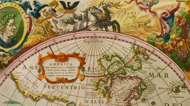
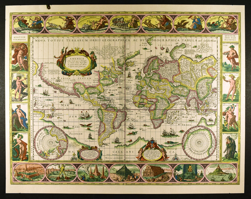
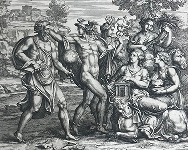
For centuries, maps have been seen as reputable sources of information, but they haven’t always been accurate representations of the geography they span. Cartographers included islands that didn’t exist. They used text to cover up unexplored areas. They illustrated similar terrains differently to make one land seem less developed than the other.
By studying the differences between maps and exploring why those discrepancies exist, we can learn about the history of the world. “A good way to understand changes at the macro level in the history of global cartography is to look closely at maps, as many and as varying as possible, and to think critically about logical reasons that might explain those discrepancies, if not even also link them together,” said Prof. Vimalin Rujivacharakul from the Department of Art History.
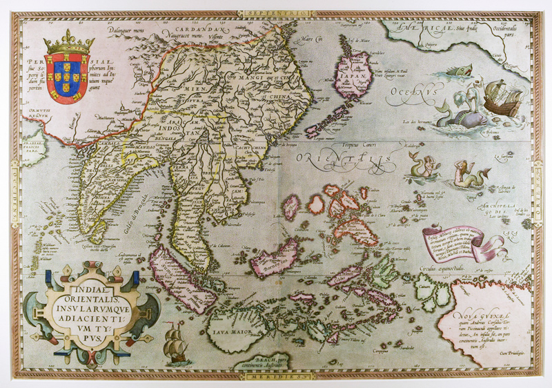
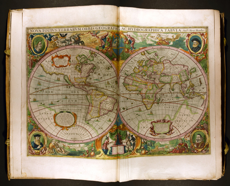
The University of Delaware has a strong collection of rare and precious early modern maps from the 16th, 17th and 18th centuries in the Library, Museums and Press’ Special Collections. Using these maps as the foundation, Rujivacharakul collaborated with staff at the Library to design four seminar courses, spanning two years, which would culminate in a student-curated exhibition.
Students in the first three seminars — a graduate seminar in Fall 2019, and undergraduate honors seminars in spring 2020 and fall 2020 — were assigned projects to create research videos about the maps. Students in the curatorial seminar then integrated these videos into an exhibition about the maps in spring 2021.
Whether comparing maps in their videos or exploring ways to link the maps together in an exhibition, students were challenged not just to learn from these maps, but also to create something that would help others engage with them.
To simultaneously study these maps and create tools for others to learn from them would be a tall order during a normal semester, but three of the four seminars also faced the added challenge of doing so during the COVID-19 pandemic.
The keys to their success? According to Rujivacharakul, it came down to three things: “patience, persistence and collaboration.”
Creating Research Videos
The graduate and honors undergraduate students in Rujivacharakul’s first three seminars already had experience writing standard research papers when they enrolled in her class. This course allowed students to build on those skills.
Working directly with the maps, students conducted object-based research. They learned how to share their research in plain language for a general audience to understand, and they learned how to create high-quality videos that allow the public to engage with the rare maps they studied in dynamic ways.
To bring such a complex assignment to life, Rujivacharakul co-taught these seminars with two of her colleagues in the Library, Museums and Press — Alex Johnston, associate librarian in Special Collections and Museums, and Jessica Barth, emerging multimedia technologies librarian in the Student Multimedia Design Center.
Students met with Johnston to delve deeper into the maps they were researching. “Alex pulled many materials from Special Collections for us to consult during class time and he offered his expertise concerning the Special Collections material, cartographic traditions, and printing and book-making techniques,” said Erin Hein, a doctoral student in art history who took the seminar in fall 2019.
In addition to the maps in Special Collections, Hein and her classmates visited the Library of Congress — a trip coordinated by the late alumnus Edward Redmond, who worked in the Geography and Maps Division of the Library of Congress — to see how their robust collection of maps complemented those at UD.
“It was such a joy to work directly with objects, and getting to see so many maps in person helped me to understand how the Mercurio Geografico [map] fit into this larger narrative of how early modern Europeans were conceptualizing foreign lands,” Hein said.
Despite the pandemic, this aspect of comparing maps across collections continued as Johnston worked to find maps from libraries around the globe, and Rujivacharakul connected her students with individuals at those institutions to learn more.
As the students researched their maps, they also worked with Barth to begin thinking through how to tell a visual story with their research and the basics of making a video. The students created storyboards, photographed the maps in Special Collections, recorded (and re-recorded) audio narration, selected background music, and built the videos in iMovie.
“I think that it was a really good experience for me, and it was my first time to create videos,” said Jizhi Zhang, a recent graduate who took the seminar in fall 2020. From controlling the speed and intonation of their voices to adding subtitles and explanatory text, Zhang and the other students in the seminars learned the nuances of video creation with Barth there to guide them. “Through one semester of study, I have confidence in making videos,” Zhang said.
While the assignment was challenging, the students developed skills they’ll be able to apply in their professional careers. “Translating the research I had done into three 3-minute-long videos was the most difficult part of the project,” Hein said. “I really had to be selective about what I included and make sure that every photograph and all of the information had a purpose and contributed to a coherent story … I also really appreciated the exercise of translating obscure, theoretical research into a format that speaks to a general audience. That is a skill that I will continue to use in the future.”
To ensure that Rujivacharakul’s students left the seminar with a meaningful learning experience took a lot of advance planning. At the outset of the seminars, she worked closely with Paige Morgan, head of the Digital Scholarship and Publishing Department at the Library.
Together, they refined and scoped the assignment so that it would be a manageable workload for the students. Morgan helped Rujivacharakul create the themed WordPress site where the videos could live, and assisted her with uploading the final videos with proper tags and labels. They also created a release form that allowed students to grant or withhold their permission to include their work on the website in an effort to prioritize student researchers’ rights and their digital, professional presences.
Curating an Exhibition
While the six students in the curatorial seminar in spring 2021 had previous experience working in galleries and curating exhibitions, it was a new challenge for everyone to curate an exhibition during a pandemic.
To succeed required collaboration at every turn.
Like Rujivacharakul’s other seminars, one way that collaboration took shape was through the guidance of internal and external curators. In addition to continued support from the Library, Rujivacharakul also invited external curators — Robert Mintz, deputy director of the Asian Art Museum of San Francisco; James Lin, senior curator at the Fitzwilliam Museum in Cambridge, England; and John Hessler, curator at the Library of Congress — to co-teach the seminar or provide guest lectures.
The other essential collaboration was between the curatorial team. In addition to their weekly Wednesday classes with Rujivacharakul, the students met on Fridays for three- to four-hour meetings to brainstorm ideas, set goals and provide progress updates. “Working together, we were able to explore different ideas, consider a number of approaches we might not have thought of individually, and teach each other about some of the works we were researching for the show,” said Tom Price, a doctoral student in art history and member of the curatorial team.
At the start of the semester, each member of the curatorial team individually visited Special Collections in Morris Library to get inspired by the University’s collection of maps. Johnston, who was involved with the earlier seminars, and Curtis Small, associate librarian in Special Collections and Museums, coordinated these visits — ensuring proper COVID-19 health and safety protocols were observed — and provided insights into the maps.
During those visits, the members of the curatorial team narrowed in on objects, subjects and themes of interest. As a group, they discussed these interests and worked to tie them together to present a connected, cohesive exhibition.
Every element of the exhibition was a team effort. The ensuing exhibition, Multiple Middles: Maps from Early Modern Times, is a result of the distinct collaboration and cooperation within the team.
“The curatorial team attempted to view the maps with a globally oriented approach, understanding the international interactions and movements of people, ideas and materials through what is delineated, implied and/or hidden on the surface of the maps,” said Yoojin Choi, a doctoral student in art history and member of the curatorial team.
Dakota H. Stevens, a doctoral student in art history and member of the curatorial team, said, “We wanted an exhibit that took how people normally look at maps and narrowed their focus to specific aspects that might turn conventional views of the world on their head.”
As a testament to the collaboration by team members, they were even able to turn the challenging realities of the pandemic into opportunities to enhance their online exhibition.
“Our main impression of many of these objects, like our visitors, is through the photos we were able to take of them,” Price said. “While normally conceived as a limitation, we used it as an opportunity to think about how we could best convey the material and conceptual richness of these objects while limited to digital representations.”
To build out the online exhibition, they worked closely with Dustin Frohlich, processing archivist in Special Collections and Museums, who formats the online exhibitions of the Library, Museums and Press. His insights and support were invaluable to the team as they brainstormed how they wanted to convey their information. “Working with Dustin … was a very engaging and encouraging experience,” Stevens said. “He never said ‘no’ to any of our ideas as outlandish as they may have seemed at the time, but always said he could try it out and see if it could be done.”
While they faced challenges along the way, the curatorial team had the freedom to design the exhibition they imagined, and they had the expert guidance to help bring their ideas to life. During the continued isolation of the pandemic, these students honed collaborative skills, like flexibility, teamwork and problem-solving, that will be essential in their careers as art history and museum professionals.
In the end, Multiple Middles is an exhibition wholly unique to the curatorial team’s combined vision and fortitude that encourages visitors to join this ongoing journey of learning and discovery by engaging with these rare global maps in dynamic and exciting ways.
The online exhibition, Multiple Middles: Maps from Early Modern Times, is now available. A physical installation of this exhibition will be on view in the Special Collections Gallery in Morris Library in Spring 2022. Find a full list of research videos created in support of the exhibition here.
Contact Us
Have a UDaily story idea?
Contact us at ocm@udel.edu
Members of the press
Contact us at mediarelations@udel.edu or visit the Media Relations website