
Humanitarian mapathon
Photo by Michael Graw November 22, 2017
Students map areas of Tanzania to help health workers reach more people with HIV prevention and treatment
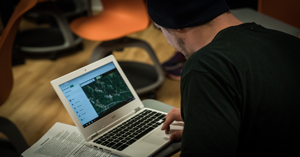
University of Delaware students documented 700 buildings and nearly 200 miles of roads in Tanzania during a humanitarian mapathon last week. The students uploaded the Geographic Information Systems (GIS) data to the crowd-sourcing mapping platform, OpenStreetMap.
The UD students are among thousands of volunteers worldwide who are contributing to the maps, which provide up-to-date resources for humanitarian organizations, in this case health workers in Tanzania who are trying to reach more people with HIV prevention and treatment programs.
To participate, students only needed a computer and Internet connection. Using OpenStreetMap, they identified buildings, roads, agricultural and other features that connect people in some way. All work is vetted by an experienced GIS professional to ensure accuracy.
“It’s as simple as clicking and tracing the outline of a structure then categorizing the item as a building, but it can have a big impact,” said event coordinator Troy Saltiel, a junior environmental science major in the College of Earth, Ocean, and Environment.
To illustrate how mapping on a personal computer can contribute to humanitarian relief across the globe, Saltiel suggested imagining driving in circles in a foreign place because a GPS can’t find the location you are trying to reach. Now imagine the same scenario, but add trying to coordinate a response to a big disaster.
“Going in blind takes up a lot of time and hinders relief,” said Saltiel, who also is pursuing a graduate certificate in GIS. “That’s where the students can come in and become part of a global effort to help improve the maps so that emergency response is improved in times of disaster.”
Fellow environmental science major Zoralis Ortiz expressed excitement in having the opportunity to expand her experience outside the classroom or lab. She especially liked how the effort unified volunteers around the task of creating comprehensive maps and data.
“Most of us were college students, but we were all different years and I saw a few professors and graduate students as well,” said Ortiz. “It's just so interesting how a free mapping program can unite people of different ages, and professional and cultural backgrounds.”
Contact Us
Have a UDaily story idea?
Contact us at ocm@udel.edu
Members of the press
Contact us at mediarelations@udel.edu or visit the Media Relations website