



Category: Earth, Ocean and Environment
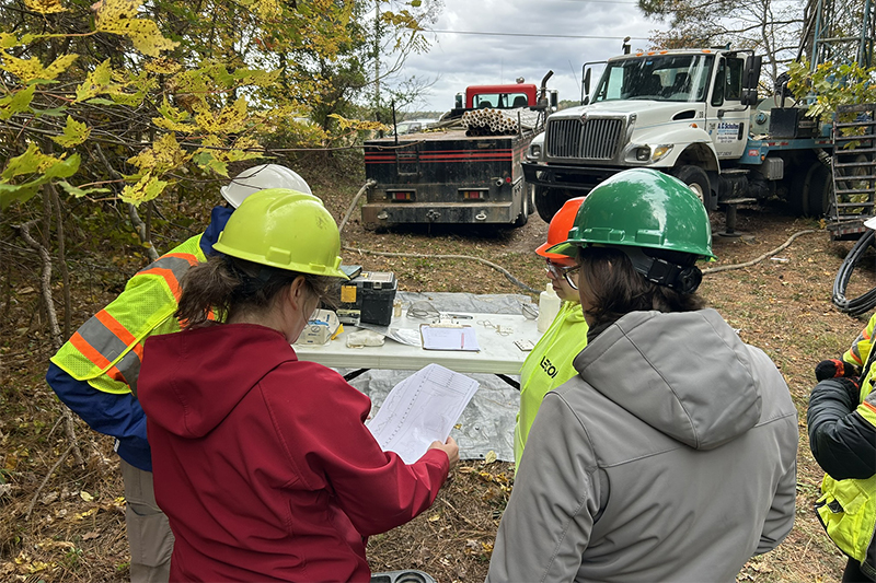
Monitoring Delaware’s Groundwater
June 22, 2026 Written by Adam Thomas | Photo by Matthew Grabowski
Since 2012, the Delaware Geological Survey (DGS) has been working with the Delaware Department of Natural Resources and Environmental Control (DNREC) to establish a statewide groundwater monitoring network. The network is used to track water levels and monitor water quality, enabling decision-makers to better manage this valuable resource.
As of this date, the network comprises 179 wells covering major aquifers that provide information on water quality, groundwater levels and salinity. Many of these wells are equipped with automated data loggers that collect groundwater levels at 15-minute intervals. This data is freely available and used by state policymakers and decision-makers for resource planning purposes, as well as by researchers at the University of Delaware.
The program at DGS, which is a state agency housed at the University of Delaware, is led by Changming He, Rachel McQuiggan and Thomas McKenna.
He, a scientist with DGS, said the network began in 2012 with monitoring efforts in Southern New Castle County before progressing down the state.
“This has been a multi-year, multi-phase project and we’re now close to the end so that we can have a whole statewide, systematic groundwater monitoring network,” said He.
To design the network, the team focused on specific points when selecting the wells and monitoring locations, with an emphasis on aquifers that supplied large volumes of water.
Throughout 2026, members of DGS have worked extensively in Sussex County to fill gaps and ensure the monitoring network covers the state in its entirety, specifically in areas of Sussex where data and infrastructure have historically been limited.
Saltwater Monitoring
In Sussex County, DGS will also monitor the amount of saltwater in the wells as part of their saltwater intrusion monitoring in Delaware’s Groundwater program. As all of Sussex County’s drinking water comes from groundwater resources, it is essential to ensure the water is clean and reliable.
McQuiggan, an associate scientist with DGS, said although they have finished installing their new wells in their Sussex County, they are working with DNREC to add more coastal wells for monitoring saltwater intrusion.
“You can never have too much data collection in coastal areas for saltwater intrusion monitoring,” said McQuiggan. “The goal is that, eventually, that work will be absorbed in the rest of the network and monitored in the same way.”
The Sussex County wells will be in areas located close to the coast, from Lewes down to Fenwick Island.
“We want it to be both spatially useful but also where people are actually using the water,” said McQuiggan.
As for statewide trends, He said that different aquifers behave differently, though he noted that the Piney Point aquifer in the Dover area has been trending downward over the past decade.
They also stressed that this high-quality data is readily available to anyone interested in learning more about Delaware’s groundwater. While the data is collected by sensors in the monitoring wells, the researchers also go out every few months to take manual measurements to validate it.
Real-time transmitters are also being added to many wells so that the information can be viewed multiple times a day.
“That real-time data was important during this past fall when we had a drought,” said McQuiggan. “It allowed us to target areas with shallow aquifers where we thought the water levels were going to possibly drop even more. We can look at that day by day when policymakers are discussing drought conditions more frequently.”
To access the data and learn more about DGS, visit the DGS website.