
Tropical cyclone behavior
Photo by Tammy Beeson June 27, 2017
UD professors collaborate with University of Nigeria-Nsukka to understand tropical cyclone behavior in Lesser Antilles
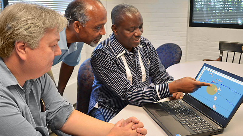
University of Delaware professors David R. Legates and Anthony Seraphin are working with Ernest Ugwu, a visiting scientist from University of Nigeria-Nsukka (UNN), to understand why tropical cyclones that approach the Lesser Antilles have a statistically lower number of landfalls than expected.
The Lesser Antilles are a chain of islands in the Caribbean Sea. Along with the Greater Antilles and the Lucayan Archipelago, they comprise the West Indies.
The researchers are studying archival records from storms that occurred between 1950 and 2016 to tease out whether there is a connection between this unique storm behavior and the bathymetry of the sea floor around the islands. The team is considering statistics on storm intensity, landfall, the storm’s path and whether it reached hurricane status, in hopes of providing data to support information for advanced warning systems and planning in the region.
“We’d like to figure out how these cyclones steer, whether that is driven by following the warm water to gain energy or whether it is tied to the bathymetric depth of the sea floor and ocean currents,” said Legates, a climatologist in the Department of Geography, which is housed in the College of Earth, Ocean, and Environment.
Subterranean mountains keep storms out to sea
Preliminary data supports that the Lesser Antilles islands provide a barrier around which tropical depressions and storms migrate. One theory is that this is due to the extensive subterranean mountain ranges that give rise to most Caribbean islands. Dominica, for example, has elevations that are almost a mile high. It’s tallest peak, Morne Diablotin, is 4,747 feet high, just 500 feet less than Denver, Colorado.
If they attain hurricane force before reaching the Lesser Antilles, storms seem unaffected by gaps between the islands. Smaller storms that are still developing, meanwhile, typically maneuver away from land that can slow them down.
A close examination of the path of Tropical Storm Iris, the storm that affected the Caribbean island of Dominica in 1995, illustrates this short-term erratic behavior, Legates said. The storm turned south toward Saint Lucia, then went due north and passed westward between Martinique and Dominica before turning due north again. The researchers suspect this was due to the ocean currents and turbulence the tropical cyclones created.
“Storms gain force and speed from warm water, typically over the open ocean. In shallow waters, winds stir up the warm water and the energy associated is expended quickly. In deeper water, however, this stirring generates more warm water from the bottom, which continues to fuel the storm,” Legates explained.
Storms that occur in the Caribbean Sea display different characteristics from Cape Verde storms that form off the African coast or in the Gulf of Mexico and tend to track northeast toward the United States.
Legates said the data indicates that sea surface temperature and the Atlantic multidecadal oscillation (AMO), a climate pattern associated with warmer Atlantic waters, dictate what happens over most of the North Atlantic basin but not near the tropics.
“We don’t see the normal precursors that lead to basin activity affecting what’s going on, but there is some indication that solar radiation and other astrophysical variables may play a role,” said Legates, who holds a dual appointment in applied economics and statistics.
As the work continues, the team will consider whether galactic cosmic rays, which scientists theorize may create more high clouds, can seed storms.
“The Earth is considered a magnet and its effect is felt in the atmosphere. Changes in the Earth-atmospheric boundary affect the development and movement of storms,” said Ugwu, a space physicist and geomagnetism expert with UNN’s Department of Physics and Astronomy.
Ultimately, Seraphin hopes the team’s data can inform infrastructure development, policy, and emergency planning and evacuation in this vulnerable chain of islands. Growing up in Dominica, he witnessed the erosion, landslides and associated devastation that can result without the technology infrastructure to support advanced warning systems like those available in the U.S.
“My interest is knowing whether the powers that be have enough information to depend upon the forecasts that are issued, and that they are in a position to provide adequate evacuation in an emergency,” said Seraphin, an associate professor in UD’s Department of Mathematical Sciences with a secondary appointment in geography.
Legates agreed. “Today we have more forecasting ability and more lead time than at any other time in history, but people are increasingly less prepared. We need to change this,” he said.
Hurricane season runs June 1-Nov. 30.
Contact Us
Have a UDaily story idea?
Contact us at ocm@udel.edu
Members of the press
Contact us at mediarelations@udel.edu or visit the Media Relations website