
Library hosts data mapping workshops
Photo by September 12, 2017
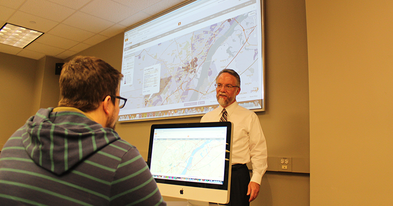
Learn how to create maps using GIS during UD Library workshops
Maps answer the age-old question, “Where am I?” But maps also provide insight on a variety of other questions, too, through the use of a geographic information system (GIS), a powerful mapping and analysis tool for spatial data.
This semester, the University of Delaware Library will hold five GIS-related workshops — focusing on PolicyMap, ArcGIS Online, Story Maps, ArcGIS for Desktop and census data — through September and October.
In each workshop, participants will create a map of a specific area and add data to it. Through these hands-on sessions, they will become familiar with data layers, a key GIS concept; learn how to convert addresses into geographic coordinates; and recognize how cartographic principles apply to creating maps that present data clearly and fairly.
“Researching and Exporting Data with PolicyMap”
The first workshop, “Researching and Exporting Data with PolicyMap,” is the most accessible for those unfamiliar with GIS. Participants will explore PolicyMap, a resource that allows them to choose from more than 37,000 indicators and a wide range of U.S. geographies to create a map. They will learn to identify and map areas meeting three data criteria, and download data from PolicyMap for use in their own research.
The workshop will be held in Room A of the Student Multimedia Design Center on the lower level of Morris Library, from 9 a.m.-noon, Thursday, Sept. 14. John Stevenson, interim head of the Multimedia Collections and Services Department, will lead the session.
Those interested in attending should register here.
“Getting Started with ArcGIS Online”
In the “Getting Started with ArcGIS Online” workshop, participants will become familiar with this cloud-based GIS resource. They will also learn how ArcGIS Online makes it easier to add data to a map that can be widely shared with others.
Led by Stevenson and Olena Smith, lead geospatial information consultant for IT-Client Support and Services, the workshop is cosponsored by UD Information Technologies.
It will be held in Room A of the Student Multimedia Design Center on the lower level of Morris Library, on from 9 a.m.-noon, Thursday, Sept. 21, 2017.
Those interested in attending should register here.
“Story Maps”
During the “Story Maps: Using Maps and Multimedia to Tell Your Story” workshop, participants will work with Story Maps, the ESRI GIS application that allows users to combine maps, text, images and multimedia in a user-friendly geographical context. They will learn how to select appropriate templates for their specific content and build Story Maps using ArcGIS Online.
Cosponsored by UD Information Technologies and the Delaware Geological Survey, the workshop will be led by Smith and Lillian Wang, GIS specialist/cartographer from the Delaware Geological Survey.
The workshop will be held in Room A of the Student Multimedia Design Center on the lower level of Morris Library, from 9 a.m.-noon, Thursday, Sept. 28.
Those interested in attending should register here.
“Getting Started with ArcGIS for Desktop”
Throughout the “Getting Started with ArcGIS for Desktop” workshop, participants will explore a GIS tool available in several labs throughout campus. They will also discover the various options ArcGIS for Desktop provides for exporting high-quality map images for use in publications or as posters.
The workshop will be held in Smith Hall, Room 010, from 9 a.m.-noon, Thursday, Oct. 5. Stevenson and Smith will lead the workshop, which is cosponsored by UD Information Technologies.
Those interested in attending should register here.
“Using Census Data and ArcGIS”
In the final workshop of the series, “Getting Started Using Census Data and ArcGIS for Desktop,” participants will discover how census data and geographies can be used with GIS.
Census data, a reliable and well documented resource, is collected and identified by geographies of all sizes. It is ideal for GIS use, but requires proper formatting to be used. In this workshop, participants will learn the steps necessary to turn raw census data into a thematic map.
The workshop will be held in Smith Hall, Room 010, from 9 a.m.-noon, Thursday, Oct. 12, 2017. Smith and Noemi Mendez, data dissemination specialist from the U.S. Census Bureau, will lead the workshop, which is cosponsored by UD Information Technologies and the U.S. Census Bureau.
Those interested in attending should register here. Some knowledge of ArcGIS is required.
All five workshops are open to undergraduate and graduate students, faculty and staff.
While workshops are free of charge, registration is required as seating is limited. For a complete listing of Library workshops, visit library.udel.edu/workshops.
All Morris Library visitors need photo identification to enter. Visitors with UD ONEcards can use those at the turnstiles for easy access to the Library. If you do not have a UD ONEcard, you will need a state-issued ID (a driver’s license, a government-issued or school-issued photo ID, etc.) to enter.
Please call 302-831-2432 or email lib-workshops@udel.edu with questions regarding workshops.
Contact Us
Have a UDaily story idea?
Contact us at ocm@udel.edu
Members of the press
Contact us at mediarelations@udel.edu or visit the Media Relations website