

Editor’s note: This is one in a series of articles featuring UD polar scientists that will appear on UDaily during the International Polar Year. For a gateway to past and future articles, be sure to visit UD’s polar research web page at [www.udel.edu/research/polar].
3:15 p.m., July 13, 2007--University of Delaware scientists played key roles in a National Science Foundation-funded spring project to better understand the motion and deformation of Arctic sea ice through fieldwork, satellite imaging and computer modeling.
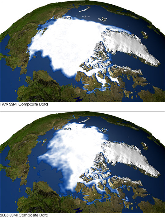
The work is central to understanding global climate change because the massive ice cover that drifts about the Arctic Ocean in a collection of individual pieces of ice, called floes, about 1-3 meters thick and ranging from 10s to 100s of meters in diameter, acts as a planetary thermostat.
The project, which was both international and multi-agency in scope, kicked off with the establishment of an on-ice field camp about March 1, which was also the official start of the International Polar Year. The NSF grant supported work by researchers at UD, the University of Alaska and the U.S. Army Corp of Engineers Cold Regions Research and Engineering Laboratory (CRREL).
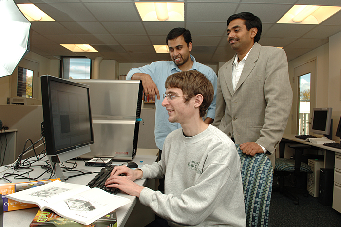
UD received $525,000 in NSF funding, with its team led by Chandra Kambhamettu, associate professor in the Department of Computer and Information Sciences and director of UD's Video Image Modeling and Synthesis (VIMS) Laboratory, and Cathleen Geiger, associate research professor in the Department of Geography with the Center for Climatic Research. Together they coordinated the satellite remote sensing portion of the project.
VIMS worked with the National Oceanic and Atmospheric Administration's National Ice Center and the Alaska Synthetic Aperture Radar Facility to collect and process images of the sea ice as they were downloaded in near-real time over an ice camp, where Geiger was stationed.
The VIMS team provided the horsepower needed to process several very large images, of about 250 megabytes each, into special ice tracking maps using a high resolution motion processing system developed by UD doctoral student Mani Thomas in conjunction with his advisers, Kambhamettu and Geiger.
Geiger, a polar scientist, and the ice camp team used the maps to conduct coordinated surveys and set up telemetry devices to monitor the behavior of the ice motion within a 150-kilometer circle. Prototype instrumentation was used to measure both the horizontal and vertical changes in the ice landscape, or “ice-scape,” over a range of scales from 1-100 kilometers with a long-term monitoring array to be left behind to transmit data up to three years.
Kambhamettu said the cooperative project investigated the mechanisms whereby the motion of sea ice, in particular the opening of cracks and their closing to form ridges, contribute to the mass balance of the Arctic ice pack.
Data collected will be used to directly validate model parameterizations of the relationship between stress and strain rate within the ice pack and the mechanical redistribution of ice mass.
The researchers will test model configurations commonly used in Global Climate Models to provide scientists with a direct estimate of how accurately such models reproduce the ridging and dynamic-thermodynamic control of the ice thickness distribution. A series of model runs will be performed to estimate sea ice mass sensitivity to model parameters and variables. Combined analysis of this model output, observations and sensor inter-comparisons will allow identification of key monitoring requirements to complement model uncertainties.
Kambhamettu said the results of this study will contribute to a better understanding of the processes contributing to variations in the Arctic sea ice pack, enhancements to models of such processes, and consequent improved predictions of the trajectory of important aspects of the climate system, such as the recently observed reduction in summer sea ice extent in the Arctic Ocean.
Kambhamettu said the VIMS Laboratory, located in Smith Hall, is integral to the success of the project. Work at the laboratory, which was established a decade ago, is focused on motion analysis and deformations. Techniques developed at VIMS have been used in the biomedical field, to better understand the development of lung tumors, and in sea ice studies, in which the scientist first became involved while working at NASA.
“Because of its reflectivity, there are a lot of highlights on sea ice, which has a textured surface,” Kambhamettu said. “The novelty of this work is being able to complete motion analysis of such hard data. We know of no one else doing such advanced level motion analysis.”
In addition, the VIMS Lab is forcing remote sensing tools to extremely high spatial scales for very detailed looks at the sea ice, working in spaces of 10 meters rather than 10 kilometers. “The accuracy of the motion analysis we have devised is very much higher and in much higher resolution than has been seen before,” Kambhamettu said. “In that way, we can provide the best of data for the models that predict the motion.”
Thomas said the VIMS Lab works at “a magnitude higher” than other such systems. “With our system, you can see structures in the ice floe field that you cannot see in the coarser images,” he said.
That enables rapid and thorough analysis that can predict discontinuity in the ice, enabling the prediction of cracks and breaks. Thomas said such information was important during the Cold War to enable submarine captains to know where to surface; today it is a tool in studying climate change.
The system is hardy, relatively inexpensive because it relies on high-speed connections such as Internet2 rather than banks of processors, and fairly easy to use thanks to a Java applet developed by UD graduate student Scott Grauer-Gray. Information from the satellite-based remote sensors is fed into VIMS, which processes the information and sends it back to the ship or research station where those who need the information can study it.
The user can hone in on precise areas, much like using Google Earth on a personal computer, then watch the ice in motion with arrows pointing the direction of the movement along the various cracks.
“We developed a generic system so anyone with a good graphics card for their computer can use it,” Thomas said, adding the information can even be sent to hand-held devices such as Blackberries.
In the future, Kambhamettu said, they hope to prepare three-dimensional views of the ice by combining satellite images with multiple cameras in the field.
Kambhamettu said the work will involve McNair Scholars at UD, and will have an outreach component that will enable high school students to log on for the latest in maps and analyses.
Article by Neil Thomas