


Improving geospatial knowledge
Professors launch DelawareView to improve public access to remote sensing and geospatial data


12:02 p.m., Nov. 18, 2015--Faculty members in the University of Delaware’s Department of Geography have launched the DelawareView (DEView) consortium to improve public access to remote sensing and geospatial data.
DEView is an affiliate member of AmericaView, a national network of remote sensing scientists and GIS scientists, funded by the U.S. Geological Survey, who support the use of Landsat and other public domain remotely sensed satellite data for research, education and technology transfer.
Campus Stories
From graduates, faculty
Doctoral hooding
Led by geography professors Byungyun Yang and Tracy DeLiberty, DEView’s mission is to provide the public with spatial data and geographic knowledge about space, place and time using remote sensing (RS) and geospatial technologies, including geographic information systems and science (GIS).
“Over the last three decades, scientists have used digital maps created by remotely sensed data to understand places and spaces on the Earth’s surface. As technology has advanced, so has our ability to capture and use this geographic information to solve global environmental problems. With DelawareView, we will be able to share the remotely sensed data and geospatial data with students, researchers and the general public,” said Yang, principal investigator and UD assistant professor of geography.
The consortium was developed in partnership with colleagues at Delaware State University (DSU), Delaware Geological Survey (DGS) and Delaware Environmental Monitoring and Analysis Center (DEMAC). Collaborators on the project include:
- John A. Callahan, DGS associate scientist;
- Hacene Boukari, DSU associate professor;
- Christina Callahan, DEMAC Lead Scientist; and
- Matt Shatley, computer research specialist inUD’s College of Earth, Ocean, and Environment.
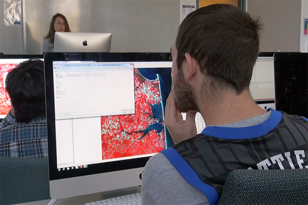
Remote sensing enables scientists to observe the Earth and detect how things are changing without being in contact with the Earth’s surface (i.e. through use of aircraft or satellite data). GIS are computer-based systems that enable researchers not only to store, process and visualize geographic information about places on the Earth’s surface, but also to improve our understanding about the nature of geographic data through scientific approaches.
From remote sensing images, Yang said, scientists can “collect land use and land cover (LULC) information that can be integrated into a GIS platform, then use the LULC information to understand or assess a variety of environmental problems caused by human activities or physical processes.”
In his work, Yang uses satellite images and LiDAR, along with GIS data, to visualize changes in the coastal shoreline. Understanding how coastlines have evolved over time can provide important clues as to a coastline’s strength or vulnerability to potential storm surge or sea level rise, he said.
Remote sensing and GIS techniques can also be used to understand large-scale events, like hurricanes or earthquakes.
“Take Hurricane Sandy, it was just too big to see the magnitude of the entire event from the ground. But if we take a snapshot from before Sandy and compare it with images from after Sandy using remote sensing techniques, in many cases, it becomes easier to identify where damage occurred and where personal ground truth work should be done,” said DeLiberty, associate professor and director of the Graduate GIS Certificate program, and co-principal investigator on the project.
Earlier this year, UD geography students participated in a citizen science effort to update geographic maps of Kathmandu, Nepal, following the 7.8 magnitude earthquake that occurred on April 25.
As DelawareView grows, Yang and DeLiberty look forward to promoting the use of remotely sensed data in K-12 education programs and to facilitating public access to remotely sensed data through a web-based interface that allows users to access, preview and download data.
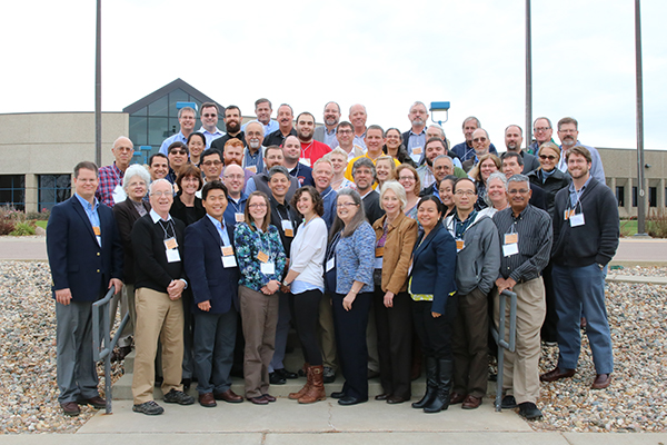
Yang recently attended the AmericaView technical meeting held at the USGS Earth Resources Observation and Science (EROS) Center, Sioux, Falls, South Dakota, in October to connect the newly formed DelawareView chapter with other remote sensing and GIS groups throughout the nation.
Article by Karen B. Roberts