Beyond maps
New secondary education program to integrate science, social studies through geography
12:53 p.m., Nov. 19, 2012--Science and social studies may be taught as separate subjects in school, but for geographers, the two overlap. The Delaware Geographic Alliance (DGA) will soon demonstrate how using fifth, sixth, seventh and ninth grade students in a newly created program.
“The idea is to couple both social studies and science curriculums to get students to understand how they are interrelated,” said David R. Legates, DGA’s academic coordinator and professor of geography at the University of Delaware. “This will better demonstrate how the sciences of climate change, hydrology and geomorphology interact with a dynamic social, political and economic landscape.”
Campus Stories
From graduates, faculty
Doctoral hooding
Funded by a $100,000 grant from the National Oceanographic and Atmospheric Administration with support from National Geographic Society, the initiative will train teachers and their students to collect field data and analyze the results using an online mapping tool.
This technology, called Fieldscope, is a web-based platform in which students can enter measurements, field notes and photos that are then plotted according to their exact location on an interactive map. The mapping process is a teacher- and student-friendly Geographic Information System (GIS), a resource commonly used by scientists and others to cross-reference data points with geographic locations and examine trends.
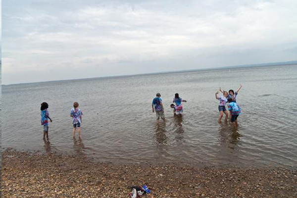
Beginning in March 2013, Delaware fifth and seventh graders will take field trips to Trap Pond State Park in Laurel, Del., to test water quality and make other measurements of the environment. Back in the classroom, they will enter precisely where the data were collected in Fieldscope, compare their findings with those of other students around the Chesapeake Bay, and analyze why there may be variations across the watershed.
“They’re acting like real scientists,” said Tonyea Mead, education associate of science curriculum at the Delaware Department of Education. “The students aren’t just sitting there listening to someone. They’re actively involved.”
Mead and Preston Shockley, the education associate of social studies curriculum at the Delaware Department of Education, are both working closely with the DGA to develop new curriculums for fifth, sixth, seventh and ninth graders, who study watersheds, regional planning, landscapes and other topics relevant to environmental science. The first stage of the project includes four school districts: Laurel, Seaford, Woodbridge and Cape Henlopen.
The goal is to relate human activities, such as farming, industry and construction, with their impact on the environment as measured in scientific metrics like higher nitrogen levels in water from agricultural runoff. Mead said making those kinds of connections can help students understand the material on a personal level, exploring questions like, “How does science affect me in my everyday world?”
Geography today emphasizes interdisciplinary relationships, Legates said. More than just memorizing countries on a map, geography examines “how things are interrelated over space.” That means it integrates various fields, including other environmental sciences as well as public health and economics.
In addition to Delaware, the program includes those states in the Chesapeake Bay watershed – Maryland, Virginia, West Virginia, Pennsylvania and New York – as well as Washington, D.C. Participating classrooms will pool their data in a common repository through Fieldscope. Students in Washington, for example, will enter data in the same system as Delaware students, allowing them to compare their results from afar.
In Delaware, the content is aligned to both the Delaware state science and geography standards, and funding supports transportation between schools and field sites for the students as well as substitute teachers during teacher training. Eventually the curriculum will expand to include the Delaware Bay watershed as well.
“The ultimate hope is that we will expand this to reach every student in the state and show them that science and social studies are inseparably intertwined,” Legates said.
This project is supported through by a grant from the National Oceanic and Atmospheric Administration, U.S. Department of Commerce, through the National Geographic Society.
Article by Teresa Messmore


